PreO sprint #1
Date: Saturday, March 21st
Event: WRE, Slovak and Czech championships of PreO sprint – part 1
GPS: 48.588626, 17.632720
Overview map: Dolný Lopašov (link to map)
Start: 11:00
Course: 25 tasks, 0.09km
Time limit: Open and Junior 28′, Physically challenged (wheelchairs) 40′ (handicap factor 0.700), Physically challenged 33′ (handicap factor 0.848)
Map: existing map from WTOC relay – updated winter 2026, 1:3000, e=2m (zoomed from 1:4000)
Old map: map from WTOC
Terrain: Semi open area of old quarry and valley with steep slope on one side
Course setter: Ján Furucz
Event advisor: Dušan Furucz
PreO sprint #2
Date: Saturday, March 21st
Event: WRE, ECTO #1, Slovak and Czech championships of PreO sprint – part 2
GPS: 48.588626, 17.632720
Overview map: Dolný Lopašov (link to map)
Start: 12:00
Course: 23 tasks and 0,06km
Time limit: Open and Junior 25′, Physically challenged (wheelchairs) 35′ (handicap factor 0.714), Physically challenged 29′ (handicap factor 0.862)
Map: existing map from WTOC relay – updated winter 2026, 1:3000, e=2m (zoomed from 1:4000)
Old map: map from WTOC
Terrain: Semi open area of old quarry and valley with steep slope on one side
Course setter: Dušan Furucz
Event advisor: Ján Furucz
TempO #3
Date: Sunday, March 22nd
Event: WRE, ECTO #2, Czech championship of TempO
Start: 10:00
GPS: 48.627795, 17.212899
Overview map: Borský Mikuláš (link to map)
Course: 9 stations, 1.2km
Map: new map from laserscan, winter 2026, 1:2000, e=1m
Old maps: solution map from 2016 TrailO competition, footo map from slovakian Routegadget, map from TrailO trainer #2, map from TrailO trainer #5, map from TrailO trainer #41
Terrain: Typical flat terrain for lowland Záhorie – pine forest with sand dunes. We recommend assistants for wheelchair competitors.
Course setter: Jonatán Furucz
Event advisor: Ján Furucz
Information about accompanying footo trainings:
Sportident is used as a punching system. The chips are read and print at the finish. The results will be available for viewing at the finish and later published on the internet.
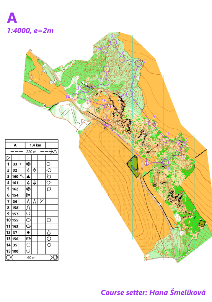
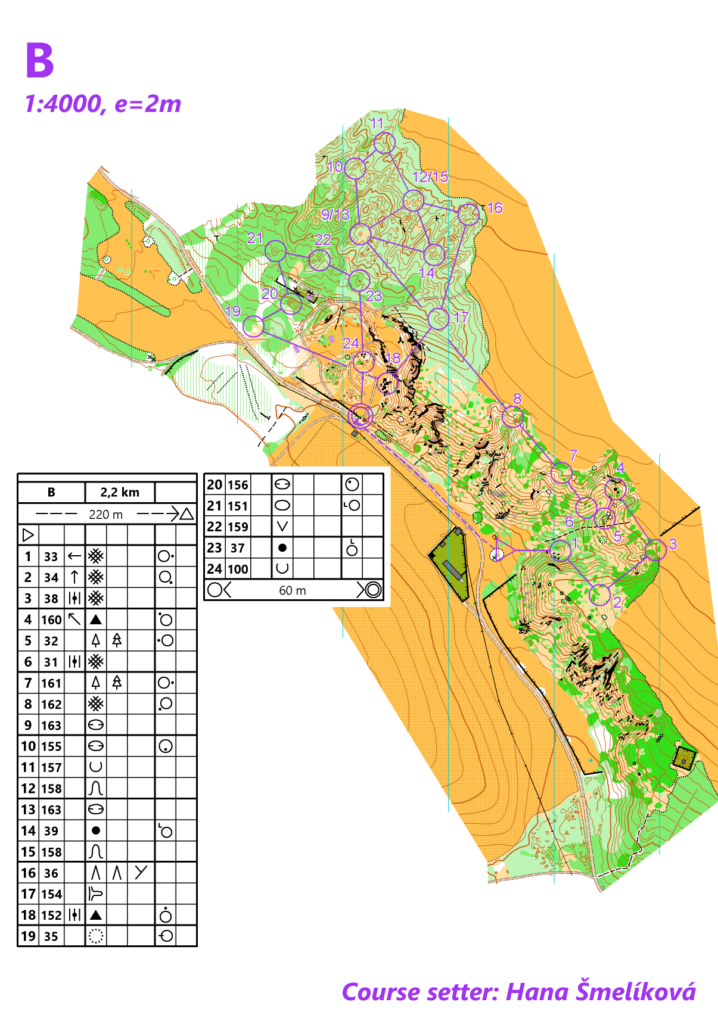
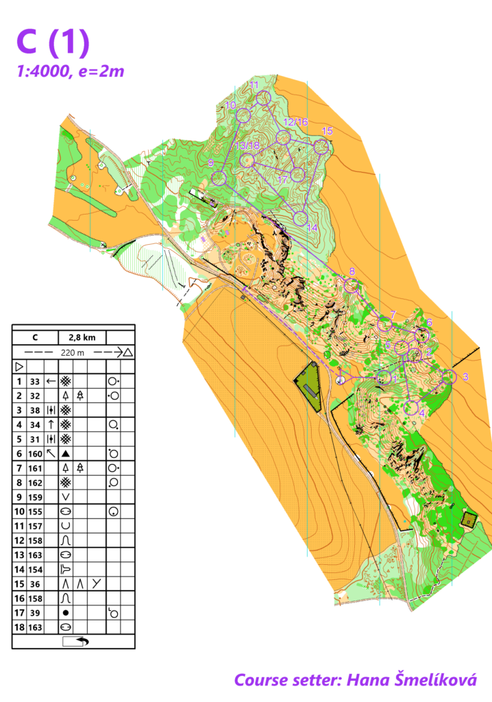
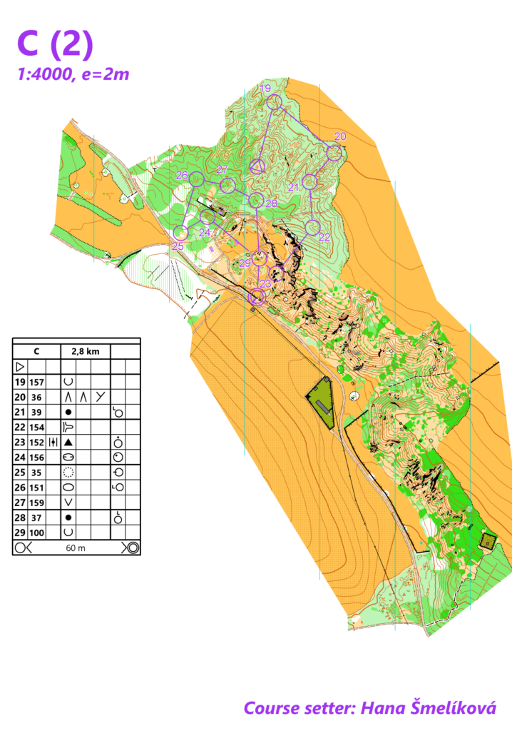
Categories: A – Short, B – Middle, C – Long
Saturday (Dolný Lopašov)
Start and finish is on event centre.
Overview map: Dolný Lopašov (link to map)
The start is free from 13:00.
Those who participate in TrailO competitions can start only after completing both TrailO competitions (partly the same competition area for TrailO and FootO).
Map: standard ISSprOM, 1:4000, e=2m.
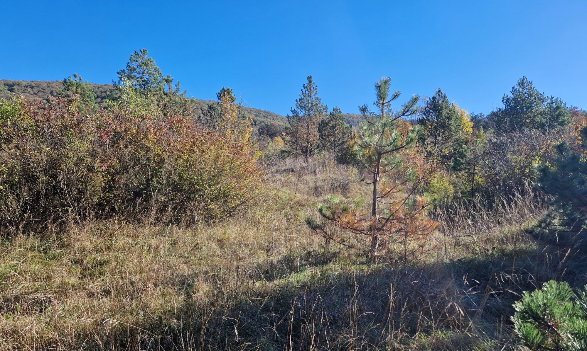
Terrain: more overgrown and there will be an elevation gain.
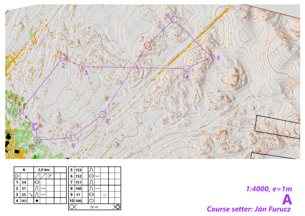
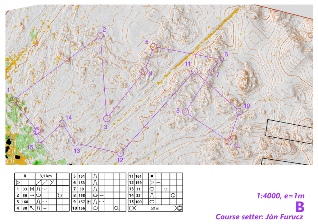
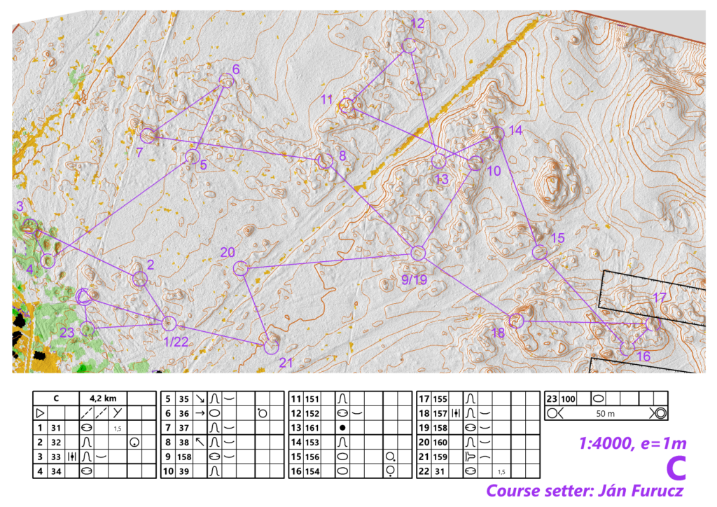
Categories: A – Short, B – Middle, C – Long
Maps with courses for Saturday training (so you can choose the right category)
Sunday (Borský Mikuláš)
Start and finish is on same place about 1.7 km from event centre (see overview map). About 0.7 km from start of TempO or about 0.75 km from last TempO station. FootO part is different from TrailO part. You can complete the course independently of the trailo competion, before or after (is it possible to go directly from the last station through the forest).
Overview map: Borský Mikuláš (link to map)
Start is free from 10:00.
Map: non standard special sprint only contours map with hill shading (generated from laser scan data), 1:4000, e=1m.
Terrain: basically flat and clean forest with lots of terrain details
Maps with courses for Sunday training (so you can choose the right category)